


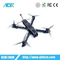


Agricultural drones are modern agricultural machinery. Agricultural drones play a role in land and soil analysis, aerial seeding, spraying operations, crop monitoring, agricultural irrigation, and crop health assessment. With the relaxation of drone regulations by governments around the world, more and more enterprises have increased their investment in research and development of agricultural drones, making them increasingly important in future agricultural production.
Agricultural drones: Utilizing drone technology for agricultural production operations such as field surveying, crop monitoring, disease and pest diagnosis, irrigation, and fertilization, to improve agricultural production efficiency and accuracy.
1. Agricultural drones meet development requirements
China is a major agricultural country with 1.8 billion acres of basic farmland. With the accelerated transformation of China's new agricultural management system, the number and scale of large growers, family farms, and agricultural cooperatives are constantly increasing, and the market demand for agricultural drones is also growing. The market can accommodate 150000 agricultural drones, with an estimated annual service value of 45 billion. In recent years, with the country identifying agriculture and informatization as key areas, aviation plant protection has made breakthroughs and shown great development and application prospects in China. The widespread application of drones in agriculture not only has great economic value, but also social value: ultra-high work efficiency, no threat to personnel safety, saving a lot of labor, saving agricultural input costs, etc., ultimately increasing the economic benefits of farmers.
Quantitative, precise, and efficient are good helpers for farmers to achieve new breakthroughs in operational efficiency
Multi functional agricultural drones have stronger load capacity and better wind resistance performance. More importantly, one machine is versatile, and different operations can be achieved by mounting onboard equipment with different functions. A flight platform can easily achieve operations such as liquid medicine spraying, solid fertilizer spraying, powder spraying, and precise seed sowing, almost throughout the entire growth process of crops, greatly saving costs in purchase, maintenance, use, and other aspects, and has a high cost-effectiveness. As an important link for precise control of seeding amount, the design of a quantizer is particularly crucial. By adjusting the speed of the quantizer, it is possible to accurately control the amount and sowing density per mu. At the same time, in order to adapt to various sowing scenarios and improve operational flexibility, the roller quantizer can be disassembled and replaced. According to actual sowing needs, different quantizers of different material slot sizes can be selected to flexibly adapt to various sowing scenarios. Finally, the seeds enter the sprayer of the seeding system, and the bypass fan inside can generate a high-speed airflow of 18m/s, which quickly blows particles towards the target area through the seeding bypass. The specially designed nozzle can further accelerate the airflow, making the spraying smoother and not affected by the environment and drone wind field. In addition, it can also effectively protect the rice seed embryo from damage during the sowing process. Its effective spraying range can exceed 9 meters, and the daily operating area can reach up to 1000-1200 acres. Quantitative, precise, and efficient homework has become a good helper for farmers to achieve new breakthroughs in homework efficiency, freeing them from heavy labor and becoming the best way to empower agricultural producers and service providers.
Unmanned agriculture is a comprehensive agricultural production process that is operated and controlled through unmanned agricultural vehicles and satellite positioning systems. People only need to make judgments and processes on the images and data transmitted by drones, which belongs to true agricultural full automation and modernization.
Unmanned agriculture relies more on technological equipment such as agricultural drones, which was a breakthrough scientific technology that emerged in 2014. The agricultural drone is equipped with a GPS navigation system for automatic cruise control and a standard camera automatically controlled by the cruise system; Ground based software allows drones to capture high-resolution ground images. The cruising software of drones uses traditional radio to control their flight, including designing flight paths, covering the farm area to the greatest extent possible, and controlling cameras for convenient image processing in the future. In a low resolution state (i.e. flying to a height of 120 meters to observe crops, which is a conventional flying altitude for unmanned aerial vehicles set by the US government. Any higher altitude requires reporting to the air traffic control department), farmers can see images that they had not seen before. Compared to images captured by satellites, images captured by drones have lower costs and higher resolution.
Drones can provide farmers with three types of detailed information. The first method is to observe crops from the air, helping farmers identify irrigation and soil problems, and even detecting pests and fungi that cannot be detected by the naked eye. Secondly, aerial cameras can provide multi-level images, capturing both ordinary visual spectral photos and infrared photos, helping farmers identify crop health issues that cannot be seen with the naked eye. Thirdly, drones can fly once a week, every day, or even every hour, providing animations sorted by time to demonstrate the growth and changes of crops, providing opportunities or identifying problems for better crop management. This is part of the data-driven trend in agricultural development.


