Unmanned agriculture
 Unmanned agriculture refers to the complete automation from sowing to harvesting, using unmanned vehicles and small drones for monitoring, and mastering and transmitting planting data through satellite systems, without the need for manual labor.
Modern farms are full of engineering miracles, high automation, and various innovations that allow farmers to grow more food with the least amount of labor. Bulldozers can go to predetermined positions and accurately sow seeds evenly and automatically at a distance of a few centimeters, while GPS positioned harvesters can accurately harvest crops. Through wireless networks, all information such as soil moisture and environmental factors are sent to remote servers for expert analysis. If people can have a more comprehensive understanding of the water content in the soil, proactively identify irrigation and pest problems, and have a more comprehensive understanding of farms, it is expected that by 2050, they can still meet the food needs of 9.6 billion people worldwide.
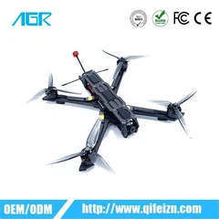
Unmanned agriculture relies more on technological equipment such as agricultural drones, which was a breakthrough scientific technology that emerged in 2014. The agricultural drone is equipped with a GPS navigation system for automatic cruise control and a standard camera automatically controlled by the cruise system; Ground based software allows drones to capture high-resolution ground images. The cruising software of drones uses traditional radios to control their flight, including designing flight paths, maximizing coverage of the farm area, and controlling cameras to facilitate subsequent image processing. In a low resolution state (i.e. flying to an altitude of 120 meters to observe crops, which is a conventional high altitude for unmanned aerial vehicles as stipulated by the US government, and any higher altitude requires reporting to the air traffic control department), farmers can see images that they have not seen before. Compared to images captured by satellites, images captured by drones have lower costs and higher resolution.
Drones can provide farmers with three types of detailed information. The first method is to observe crops from the air, helping farmers identify irrigation problems, soil problems, and even pests and fungi that cannot be detected by the naked eye. Secondly, aerial cameras can provide multi-level images, which can capture both ordinary visual spectral photos and infrared photos, helping farmers identify crop health issues that cannot be seen with the naked eye. Thirdly, drones can fly once a week, every day, or even every hour, providing animations sorted by time to demonstrate the growth and changes of crops, providing opportunities or identifying problems for better crop management. This is part of the data-driven trend in agricultural development.


